Precision Aerial Surveys, Photography, & Videography
Your Unmatched Perspective Above Montana
Billings Helicopter Charters offers comprehensive aerial survey solutions across Montana, leveraging the unique low-flying and hovering capabilities of helicopters for precise data acquisition. Our services encompass advanced applications like magnetometer and electromagnetic surveys, LiDAR, and detailed GIS mapping. Furthermore, we specialize in advanced aerial filming and photography, providing access to highly specialized equipment, including door removal options for handheld work. For critical infrastructure assessments or detailed visual documentation within Billings, Yellowstone County, and beyond, we ensure optimal options for your project requirements.
Aerial
Surveys
LiDAR, GIS Maps, FLIR, HD Video & More
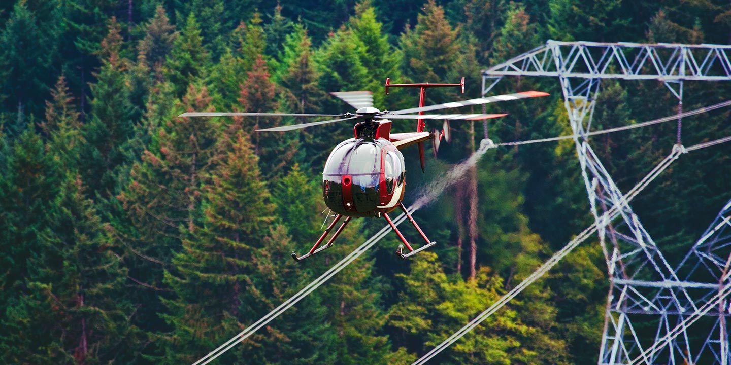
For critical infrastructure projects, including pipeline integrity assessments, Right-of-Way inspections, and transmission line patrols, Billings Helicopter Charters delivers robust solutions. We facilitate access to suitable aircraft, essential equipment, and the necessary expertise to ensure precise project execution. Our approach guarantees thorough assessments and reliable completion of your vital infrastructure maintenance and inspection tasks across Montana.
High Tech Results
The Top Pilots in Montana, Today's Technology... Maximum Results.
Call 1-866-826-4826 Now!
Billings Helicopter Charters provides the tools needed to complete your land surveys, utilizing the right equipment to provide the aerial photos that are often needed.
An effective aerial survey simplifies complex tasks such as Right-of-Way and site inspections, the collection of precise topographical data, or capturing high-definition imagery for commercial projects. Helicopter surveys offer the optimal method to meticulously examine the diverse Montana terrain, identify potential pipeline anomalies, detect issues with critical transmission lines, or acquire detailed video and photographic documentation of property. Billings Helicopter Charters specializes in developing tailored photographic and remote sensing operations, custom-fit to maximize both technical efficiency and financial returns for your specific objectives.
The helicopter's inherent ability to operate at significantly lower altitudes and reduced airspeeds compared to fixed-wing aircraft makes it the ideal platform for detailed aerial surveying. While fixed-wing operations are typically restricted by FAA regulations to a minimum of 1,000 feet above the highest obstacle, helicopters offer unparalleled flexibility for close-range observation. This capability is critical for inspecting challenging or hazardous zones, providing engineers and project managers with unique, otherwise unattainable perspectives essential for comprehensive assessment and planning.
There is no better way to conduct your visual survey, animal population counts, soil drainage analysis, ROW inspections, pipeline and transmission line inspections, and geographical surveys.

LiDAR Imaging
Light Detection and Ranging, or LiDAR, is a remote sensing method used to examine and measure Montana topography as well as objects, like vegetation, upon it.

Infrared Imaging
Thermographic IR cameras are used to detect radiation in the long-infrared range of the electromagnetic spectrum and produce images of that radiation, called thermograms.

HD Video Gimbal Capture
Modern HD and 4K cameras can be mounted to helicopters, using the proper STCs, with a gimbal to stabilize photos & videos for detailed results.
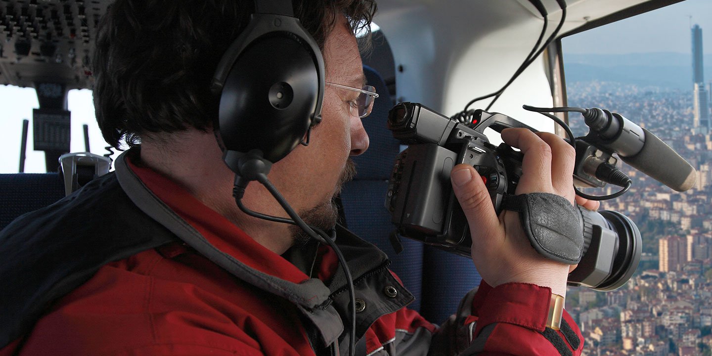
Advanced Aerial Filming and Professional Visual Capture
For expert camera work in the Billings Sky
Get a Fast, free QuoteBillings Aerial Cinematography
Billings Helicopter Charters provides access to comprehensive resources for professional-grade aerial cinematography across Montana. We facilitate advanced technology for custom shoots, featuring state-of-the-art gyro-stabilized camera mounts such as Tyler Mounts, Wesscam, Cineflex, Pictorvision, and SpaceCam, alongside specialty cameras like Cineflex HD, RED Epic, and Arri Alexa, including 3D and experimental options. Our network supports all facets of your production, from dynamic air-to-air to precise ground-to-air shots, working in close collaboration with aerial DPs and directors to achieve desired visual outcomes. Specializing in both still and motion photography, Billings Helicopter Charters provides for a wide array of media operations throughout Montana, including film, television, documentaries, promotional videos, commercials, aerial props, and comprehensive coverage for major events.
Call Us Today at 1-866-826-4826 for a Free Quote
Contact Us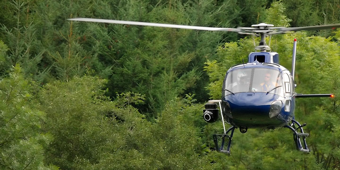
Aerial Photos
Hand-held or Mounted OpTions in Billings
We will help you get the right equipment for your aerial photography project! Call 1-866-826-4826 today to get a fast, free quote.
The Most Options for Photography
The breathtaking vistas and spectacular settings of Montana are most effectively captured from an aerial perspective. Discover the unmatched potential of our aerial photography charters, meticulously designed to exceed your expectations and help you precisely visualize your artistic or commercial objectives. Billings Helicopter Charters is prepared to offer cost-effective photographic opportunities of this caliber across Montana, from the Yellowstone River Valley to the Beartooth Mountains. Many helicopters can accommodate door removal for handheld projects, and we encourage contacting us for details on gyro-stabilized mounts to achieve enhanced stability and precision.
Superior Service
Every one of our customers gets a dedicated helicopter expert to assist with flight plans, tech loadouts, production logistics, project schedules, and other demands.
Over 500 Aircraft
Our network of direct air partners extends well beyond Billings, Montana. This allows us to offer a wide range of solutions for even the most sophisticated projects.
The Best Equipment
From high-tech sensors like LiDAR, FLIR, and GIS to HD cameras and movie production gimbals, we're here to make your job as easy as possible.